Data Management at Martin Van Buren NHS
Written by: Holly Fieglein
Our overarching goal here with this internship’s partnership with Martin Van Buren National Historic Site is to map archaeological sites for use with planning for future buildings and projects, in conversations with the Tribal Historic Preservation Offices (THPO) and State Historic Preservation Officers (SHPO). This is being done using ESRI’s ArcGIS Pro software, their online portals and GPS software. In the end all of the data will include past historical digs collecting Shovel Test Pits (STPs), metal detecting, trenches and sites. We will then categorize them as positive or negative, their depth, resources found, period etc. This will give us ample data to create a sensitivity layer and will help us to portray what areas are most delicate in regards to areas that may have the most archaeological significance.
Using this information, we can extrapolate where future research should be focused, and where to avoid disturbances.
The final outline will be a geodatabase with approximately 25 layers, with thousands of points, lines or polygons which will all illustrate utility lines, buildings, ponds, waysides, gardens, parking, roads, wells, and trees. These will all be separated into different “layouts” which are essentially separate maps which will portray specific periods, utilities or archeology. Within all of this data they have their “attributes” , this is the details of the data, to create this data it takes hours of combing through documents to find references, and metadata which then provides the context needed to understand the history of a spot.

The lessons in this come greatly back to data management, with this being a pioneer of a project, it has been an opportunity to set a standard for how data should be imported or exported from NPS’s existing systems like IRMA, Integrated Resource Management Applications. How data should be stored and shared when it is sensitive and who it should be restricted from. These questions are why it is important that we have partnered with the NE Regional GIS and Archeology folks for their support and guidance on this project.
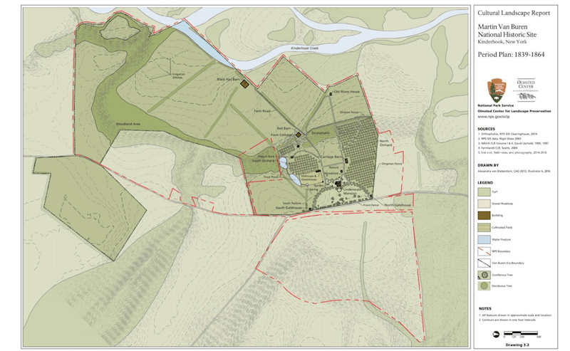
The attached map is of similar style that will come from this project, it was created from the Olmsted Center for Landscape Preservation and depicts 1839-1864 Lindenwald. It was posted in the 2016 Cultural Landscape Report for Martin Van Buren National Historic Site.