Meet Me, My Park, and My Rocks
by: Mariah Walzer

Trying on my Dad’s old Park Service hat
Hello everyone and welcome to the world of archaeology at Monocacy National Battlefield! First up, a couple quick introductions. My name is Mariah Walzer, and I am the Archaeological Research and Cultural Resource Management Intern at Monocacy this summer. I graduated from Hamilton College in 2017 with my Bachelor’s in archaeology and creative writing. I love getting my hands dirty and geeking out about old things. My dad is a retired National Park Ranger, so I’m excited to be continuing the family legacy!

A display at the Visitor Center. The quote reads: “Here was a race between the two great contending forces, the state of which was the capital of the nation, its treasure and its prestige.” – Civilian Glenn Worthington
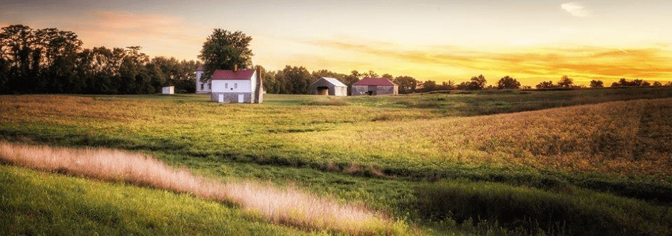
Second introduction: the park! Monocacy National Battlefield is located just outside of Frederick, Maryland. It’s the site of an 1864 Civil War battle and also a camping place for Union and Confederate troops in 1862 and 1863. The Battle of Monocacy is not well-known, but was quite important to the outcome of the war. In short, Confederate troops were marching towards Washington D.C., and Major General Lew Wallace, with vastly outnumbered and largely unexperienced Union troops, held them off for a day, just enough time for Union reinforcements to arrive in D.C. to protect the nation’s capital. Who knows what would have happened if the Confederate Army had not been delayed and succeeded in capturing Washington?

Map of Monocacy National Battlefield. From the Monocacy National Battlefield website.
In addition to the Civil War history, Monocacy also showcases agricultural life in the eighteenth and nineteenth centuries, including slavery at L’Hermitage farm. Much of my work so far also involves the Native American artifacts found in the park, which date back more than 10,000 years ago. This is one of the things that I really love about archaeology: getting to discover and tell the stories of people who don’t have their own voice in history, the lesser known stories of a place.
I started my internship almost two weeks ago now, and I have been busy busy busy. The big project we’re working on right now is completing ASMIS surveys for the park. Essentially, this means going around to known archaeological sites and checking on them, making sure no one is digging or vandalizing them and looking for any artifacts that may have moved to the surface in the last year. Thankfully, the sites have all been in good condition so far, and we’ve found a few artifacts too!

View of Best Farm, also known as L’Hermitage. In 1800, this farm was home to ninety enslaved persons, the second largest population of slaves in Frederick County. Photo from the Monocacy National Battlefield Facebook page.

View of Thomas Farm from my living quarters. The building to the far right, most hidden by trees, is where I work on the days I’m in the office.

Taking notes on a projectile point we found during survey. This is the bottom of a Savannah River Point which dates somewhere between 3650 BC and 1525 BC.
When we find projectile points, I try to identify what type they belong to. Archaeologists group projectile points from a specific region by shape and size to create categories, known as types. Because we know roughly when each type of point was common, we can then use the projectile point types we find to date a site.
Another project I worked on last week was creating a display of stone tools for the Visitor Center. I identified the tools, wrote labels and little informational blurbs for them, and then used PowerPoint to design the layout of the whole display. It was fun putting my museum studies knowledge to work!

Laying out the artifacts for the display – five projectile points, a piece of groundstone broken in two, and a cupstone (a form of groundstone with a cup-shaped indentation).

I used PowerPoint to design the layout for the artifacts and accompanying text. PowerPoint is great because it allows you to make your slide fit the size of the display, so you can know exactly how much space every piece takes up.
I suppose now would be as good a time as any to go through some vocabulary that may come up:
- Lithics – stone tools, including projectile points and groundstone
- Projectile points – the term archaeologists use for the pointed tools that tip arrow and spear shafts, commonly known as “arrowheads”
- Groundstone – stone that has been smoothed and shaped either for a specific purpose (like an axe or mortar and pestle) or through use (like a flour grinding stone)
- Flake – a small piece of stone that is knocked off when making stone tools
- Biface – a stone tool that has flakes taken off on two sides
- Uniface – a stone tool that has flakes taken off on only one side
- Ceramics – pottery of any kind
- Sherd – a broken piece of pottery or glass
- Survey – a systematic way of looking for artifacts or sites, usually on the surface; often a survey involves walking across an area in straight, parallel lines evenly spaced apart
Archaeologists use a lot of jargon, so feel free to leave me a comment if I ever use a term that you’re unfamiliar with, and I’ll be happy to define it for you!
That’s all for now!