Mapping Religion & World War II
Written by: Ella Wagner
August 5 is the final day of my DHA internship! I can’t believe how fast the time has gone.
I wanted to use my last share-out to discuss what I’ve learned about mapping capabilities using NPS.gov. Bear with me since this might get a little technical!
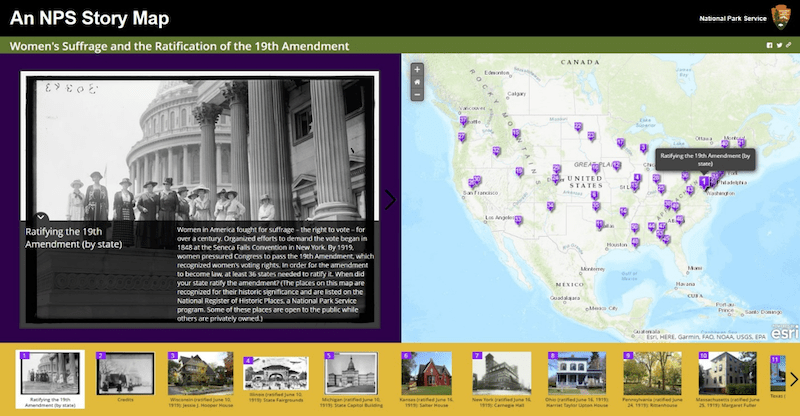
When I initially started this project, I hoped to use the StoryMaps platform to organize the places I identified and create a user-friendly and eye-catching way to explore religion on the World War II home front. ArcGIS StoryMaps were developed by Esri, an external software supplier, and the NPS has special templates available to make use of this tool. The office where I work has used StoryMaps in the past to great effect, such as for the below image of a map on suffrage history.
‘
However, the NPS digital media folks are now discouraging the use of StoryMaps because of concerns about their long-term sustainability. Fortunately, we now have an internal NPS tool called NP Maps that can be used to create maps. Unfortunately, there is not currently a way for users with little to no coding knowledge (i.e., me) to use this tool to create maps as detailed and content-rich as the one above.
Luckily for me, NPS web developers are working on this! Big shout-out to Sean Clifford, an IT specialist with the Web & Print Media Team, who has been working on creating a template that will be 1) functional, 2) 508 compliant and user-friendly, 3) compatible with the NPS Content Management System (CMS) and 4) easy enough for non-coders to use.
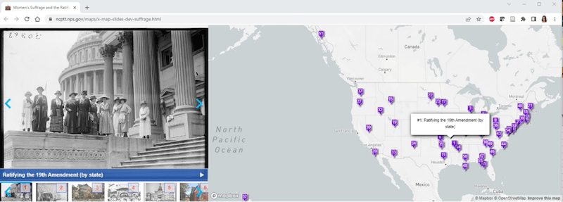
Here is a screenshot of an early version of the new tool:
Hopefully, this new tool will be available this fall or early winter. And fortunately, I’ll be around to make use of it. After some time off, I’ll be returning to the Cultural Resources Office of Interpretation and Education and starting a new position in early October. Through a contract with the National Council on Public History, I’ll continue to work on creating research and interpretation of the World War II home front. I look forward to translating this summer’s research into a shiny new mapping tool, as well as to building upon my work to explore and share more historic places.
Thanks to my team at CROIE and to everyone at ACE for making this summer a great experience!