SEE, RECORD, MAP
The first week of July turned out to be short and sweet. I spent the 4th of July holiday in Maine, and returned to the office ready to finish the existing condition mapping for Baker-Biddle. I enjoy the process of mapping and incorporated it into many of my undergraduate projects. (I just graduated in May with a BLA (Bachelor of Landscape Architecture) from Virginia Tech.)
Mapping follows a general workflow: define your scope/boundaries, consolidate existing maps/data, inventory and photograph the site, review and analyze field notes and photographs, digitize data in ArcMap or AutoCAD, and refine using a design editing software (like Adobe Illustrator). Looking back to where I started the Baker-Biddle map – with an orthophoto, a park boundary layer, and LiDAR contours – from the progress I have made, I am amazed.

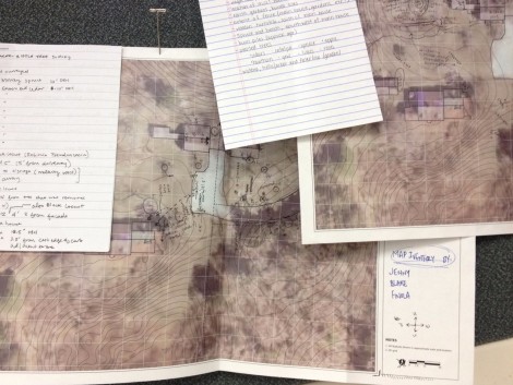
Baker-Biddle Inventory Maps: These are just two of the inventory maps I referenced when composing the digitized one.
Sometimes map making feels like a detective story. You build a map from the evidence you have, sometimes this means double-checking your leads and comparing different sources. During the Baker-Biddle site field inventory, teams recorded the physical environment by annotating printed maps, making notes, and photographing elements of the landscape. Once back in the office, I dug through these maps and transferred the notes onto AutoCAD, where I organized them to be easily navigated.

Photo from the Field: The photographs from the site visit proved invaluable when working on the map, because they helped me to define elements unclear in orthophotos.
I worked in “three-dimensions” by comparing orthophotos (aerial photography) to map notes to field photographs. I placed the element by the aerial photo, noted its characteristics by the notes, and verified its association to surrounding elements by cross-referencing photos. Next, I needed to decide how to represent different types of elements on the map. Although I am yet to begin the ‘illustrative’ component of mapping, it is important to consider how you want the map to read.

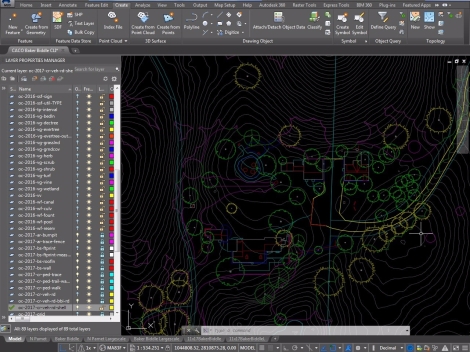
AutoCAD Map-in-Progress: This is how a working AutoCAD file appears; the colors translate to different shades and line weights once plotted to PDF.
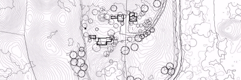
The final AutoCAD document appears at first to be a tangle of colored lines and shapes; however, the lines will take on specified properties once plotted and can be edited individually in Adobe Illustrator. After the many hours put into the AutoCAD Baker-Biddle map, I cannot imagine relying on hand-drafting to produce the map. The ‘undo’ feature (as I have discovered) is a blessing.

Plotted Baker-Biddle Map: The map that I will import into Adobe Illustrator looks like this; however, I will be able to work with each layer individually to create layer styles and organization.
Until next time,
Jill
