The Enderts Beach Coastal
Plain
by: Aleck Tan
My name is Aleck Tan and I am serving as a Cultural Resource Management intern at Redwood National Park in Orick, California. For my internship, I am creating an archaeological report on the cultural landscape of the Enderts Beach Coastal Plain area in Crescent City, California. The Enderts Beach Coastal Plain is unique in that it does not allow for ground surveying and excavations easily, since it consists of heavy brush and grass. There are some piles of dirt here and there that I can examine for cultural resources, but for the large part, there’s not much that I can see from the ground.
Because I can’t see much from the ground, I am focusing on researching historical imagery, maps, and documents to create the survey report. I am examining old aerial photographs and historic maps to see where cultural resources were located before. I am also working with the Tolowa Dee-Ni’ Nation, one of the Native American tribes in the area, to discuss their cultural resources. On June 13th, I went out with a group of tribe members to walk on the beach, and talk about their marine resources.
Another aspect of the project is researching and mapping vegetation, because there might be patterns that show historic cultural resources, which is unique in my opinion. Usually, archaeological surveys focus on what we see in the dirt, rather than what we see growing on top of the dirt. I’ve done a similar vegetation study before, where I examined vegetation at an ancient Maya community in Belize to detect causeways, but not to this project’s extent.
For this project, I have to be very familiar with the background of the plants because they might have been planted there before for certain reasons. In order for me to know more about the vegetation, I went out on June 14th with a NPS plant ecologist for a vegetation field tour, which was very informative. We walked around my study area to identify native and invasive plants and to collect samples for plant pressing and identification. One of the plants of interest is the invasive rose, which only grows and stays where it is planted. I am studying the patterns of these planted rose bushes, among other types of vegetation, to see if they might indicate some sort of boundary or cultural resource. For example, the rose bushes might line up with an old wagon road or an old fence line, but I will have to see when I map them out in the field.
I’m excited to see how mapping vegetation might indicate cultural resources, and look forward to sharing what I find.

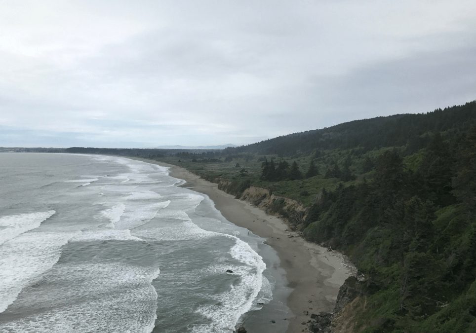
My study area is Enderts Beach in Crescent City, California. More often than not, days are gloomy and foggy, so when there is a sunny day, everyone takes advantage of it and goes to the beach or the river. I enjoy both the foggy cold days, and the bright sunny days, and still go to many of the beaches around here either way.
For my survey project, I am looking at both the beach and the coastal plain that is located right above the beach. It is a dream to survey right near the beach where you can hear the waves crashing and feel the cold ocean breeze.

June 13, 2017 – Tolowa Dee-Ni’ Marine Resources Field Tour with tribe members.

June 14, 2017 – Vegetation Field Tour with NPS Archaeologist and NPS Plant Ecologist

June 15, 2017 – Pressing plants for preservation and identification. The plant ecologist suggested I press plants so that I can keep them for the future and use them to help with identification when I am out in the field.